
Dark Sky Map: How to Use It to Pick a Stargazing Trip That Actually Pays Off
A dark sky map is a useful first filter. Learn the five checks that turn a dark region into a safe, practical stargazing trip.

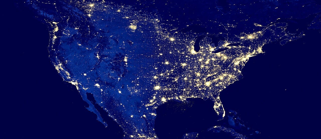

A dark sky map can make you feel smarter than you actually are. You zoom out, find a big green patch, tell yourself the stars will be incredible, then book a stay that still leaves you staring over a lit parking lot, behind a ridge, under the wrong moon, after a punishing night drive. The map did not lie. You just asked it the wrong question.
My short answer: use a dark sky map as a first filter, not a booking decision. Pair it with moon phase, horizon direction, drive reality, and one backup area. If you skip those extra filters, you are not planning a dark-sky trip. You are guessing with prettier graphics.
What a dark sky map is actually good for
DarkSky International points travelers toward map tools because they are good at revealing where light pollution drops and where certified dark-sky places exist. NASA’s current skywatching guidance keeps bringing viewers back to the same practical move, get away from city lights and use the dark nights around the new moon. National Park Service material explains why this matters so much. Light pollution hides the stars and the Milky Way for huge numbers of people, so even a short move away from metro glow can change the night dramatically.
| Question | Can the map answer it? | What else you need |
|---|---|---|
| Is this area darker than my city? | Yes | Not much else |
| Will I see the Milky Way clearly tonight? | Not by itself | Moon phase, clouds, and horizon |
| Is this a good overnight trip base? | Only partly | Road access, safety, and backup sites |
| Is this worth a long drive? | Only partly | Fatigue, lodging, and side-trip value |
The four-step way to use a dark sky map correctly
Start broad: find a dark region, not a single pin. Layer moon timing immediately: NASA keeps stressing dark nights near the new moon because moonlight often ruins an otherwise strong site. Check whether the dark patch is usable: club and park resources repeatedly describe these maps as a first step, not the whole answer. Keep one backup area: a stargazing trip without a fallback is fragile.
Filter for a usable night, not the darkest color
SearchSpot can compare darkness with moonlight, horizon, safe access, drive fatigue, and lodging before a remote pin becomes a bad plan.
Compare my dark-sky options
A dark sky map needs five more layers before you book
1. Map darkness versus local glare
Map colors describe broad sky brightness, not the lamp beside your parking space. Zoom out to compare regions, then zoom in for roads, towns, industrial sites, sports fields, and the direction of the nearest city glow. A slightly brighter region with a protected southern horizon can beat a darker pin aimed directly over a lit town.
2. Moon and target timing
The Moon can wash out faint objects even in a dark region. Match the lunar phase and rise/set timing to what you want to see. A bright Moon can still support a beautiful landscape night, but it is a poor default for a Milky Way-first trip. Do not reduce the decision to one calendar label; check when moonlight overlaps your observing hours.
3. Clouds, smoke, and horizon
A light-pollution layer says nothing about cloud, wildfire smoke, dust, fog, or mountains blocking the target. Check a current forecast close to departure and keep a second site in a different direction or elevation band. The fallback should be reachable without improvising on unfamiliar roads after midnight.
4. Legal, safe night access
NASA recommends a wide, open location away from bright city lights and explicitly says the place should feel safe at night. Confirm gate hours, parking rules, road conditions, restroom access, and whether the land manager permits after-dark use. A dark roadside shoulder is not an observing site. A certified Dark Sky Place can reduce uncertainty, but its own current visitor page still decides access.
5. The drive-home limit
Set the maximum post-observing drive before choosing the site. If the group will stay out late, nearby lodging is a safety feature, not an indulgence. The darkest point on the map is not the best choice when reaching it requires a tired, unfamiliar return drive with no services.
Use this dark sky map decision rule
Choose the darkest region that passes all five practical checks and still offers a fallback. If two regions pass, prefer the one with easier legal access and a shorter drive over a marginal map-color advantage. That rule produces fewer heroic failures and more nights when people can relax, let their eyes adapt, and actually look up.
How far should you really drive?
For most travelers, the smartest dark-sky trip is not the darkest spot on the whole map. It is the darkest spot you can reach without turning the night into a grind. A two-hour drive to a very dark, easy-access area usually beats a five-hour mission to a technically superior site that leaves you tired and rushed.
When a certified dark-sky place matters
Certification often signals more than darkness. It can mean better visitor expectations and fewer ugly surprises. That does not make every certified place automatically better than every non-certified spot, but it reduces randomness.
The call
Use a dark sky map to eliminate obviously bad areas, then build a real trip around the surviving region. Pair it with the new moon, keep the drive sane, and always preserve one fallback option. If you do that, the map becomes genuinely useful. If you do not, it becomes another false-confidence machine.
Turn the map into a real weekend
Connect map layers, current timing, two observing sites, and a weather fallback into one workable stargazing trip.
Build my stargazing weekend
Check before you go
Schedules, access, route status, prices, hours, and safety rules can change. These official pages were checked on August 23, 2026; recheck them before paying or traveling.
Turn this research into a real trip plan
SearchSpot helps you compare stays, routes, neighborhoods, and decision tradeoffs in one planning flow so you can move from reading to booking with more confidence.